
 to add an item to your Itinerary basket.

16 miles (26 km) | 677 metres total elevation
Download: OS Map | Official GPX File
Recommended time: Up to 2 days
Key points of interest
- Explore the scenic market town of Alston
- Enjoy the unique surroundings of the North Pennines National Landscape
- Tick off the highest point along the whole route and make a detour to Cross Fell
Section one overview
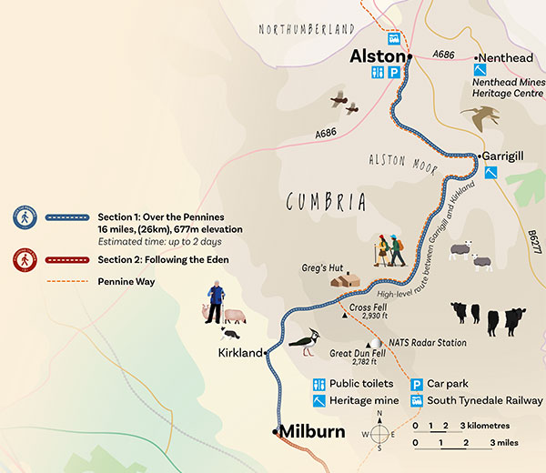 Alston is one of the highest market towns in England. Enjoy it’s pretty cobbled streets and historical buildings before starting your journey on the Westmorland and Furness Way.
The town is surrounded by the spectacular landscapes of the North Pennines - designated a National Landscape due to its special geological features, rare habitats and wildlife, and industrial heritage including mining.
The start of the route heads south along the River South Tyne, part of the Pennine Way, Pennine Journey and South Tyne Trail. Look out for dippers, otters and grey wagtails in the fast-flowing water.
After around 4 miles (7km) you will arrive in Garrigill - much smaller than Alston but still offering some accommodation, public toilets and a post office.
Next, leave civilisation behind and begin the steady climb up onto the open moorland of the North Pennines National Landscape. Pass by remnants of old mines and keep your eyes open for black and red grouse, short-eared owls, merlin and breeding waders. As you climb higher into the fells, look for rare alpine and montane plants.
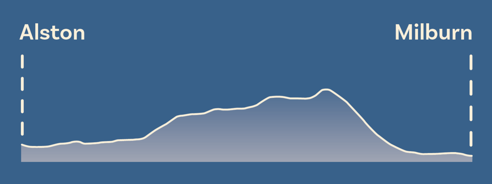
Near the top, you’ll see Greg’s Hut - the highest bothy in England built from the ruins of a lead-mining blacksmiths shop - a good spot for lunch and perfect shelter in bad weather. Soon after, you will reach the highest point on the entire Westmorland and Furness Way at 789 metres.
From here make the short, steep detour onto Cross fell (893m) - the highest point in the Pennines with great views over the Eden Valley and the Lake District.
The route now leaves the Pennine Way and continues on the Pennine Journey to descend steeply into the Eden Valley - past the hanging walls of Mark Anthony (former cultivation terraces) - to Kirkland before continuing through fields to Milburn.
Milburn is home to sandstone buildings arranged around a wide village green in a medieval fortified layout. Learn more at St Cuthberts Church.
Top tips
- This section is good for high fell terrain and vast mountain views.
- Stock up on supplies in Alston as there are only limited options in Garrigill and after that you won’t encounter another shop until Appleby-in-Westmorland during section two.
- If you plan to arrive in Alston around lunchtime, why not walk to Garrigill on your first afternoon - therefore splitting section one into two days. If staying in Alston, arrange transport back to your accommodation in advance.
Accommodation
As Alston is a popular destination for walking, it’s recommended to book well in advance over the summer months. There is limited accommodation in Garrigill, Kirkland and Milburn. 4 miles (7km) beyond Milburn, there are more accommodation options in Dufton during section two.
Public transport
Arrive at Haltwhistle train station on the Carlisle to Newcastle line and take the 681 bus service to Alston - operated by Go North East.
The 889T bus service, operated by Wrights Coaches, runs between Hexham and Alston on Tuesdays. Timetable information is available from Wrights Coaches.
Milburn has no regular bus service, but the Fellrunner community bus provides a service to and from Penrith every Tuesday.
Things to do nearby
- In Alston, take a ride on the heritage South Tynedale Railway. Opened in stages from 1851 to 1852, the line was designed to transport minerals and connect remote communities.
- Near Alston, head underground to learn more about the industrial heritage of the area with a tour at Nenthead Mines.
Route updates
Check our news section for any updates on the route.
Section One Interactive Map
Search
- Accommodation
- Things to Do
- What's On
- Food & Drink
Accommodation
Things to Do
What's On
Food & Drink
Accommodation
Things to Do
What's On
Food & Drink
Follow The Lake District, Cumbria on Social Media
Receive all the latest news, special offers and information from the Lake District, Cumbria


Ratings Powered By


© Cumbria Tourism