
 to add an item to your Itinerary basket.


Jump to: Planning your walk | Clothing and equipment | Staying safe | Responsible Walking
 Route overview
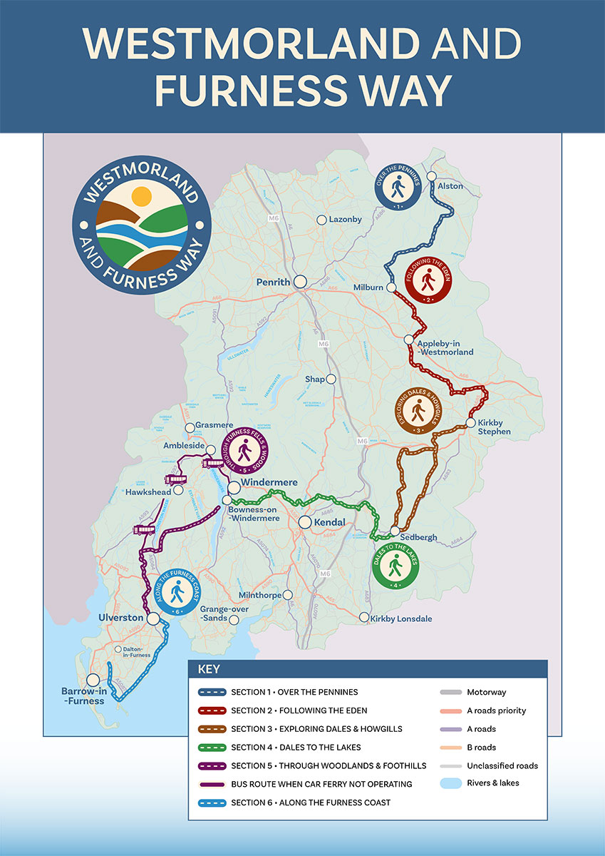
The Westmorland & Furness Way stretches for 120 miles (193 km) from Alston in the north to Furness Abbey in the south. The route can be enjoyed in either direction and Penrith provides an alternative start/finish point to Alston.
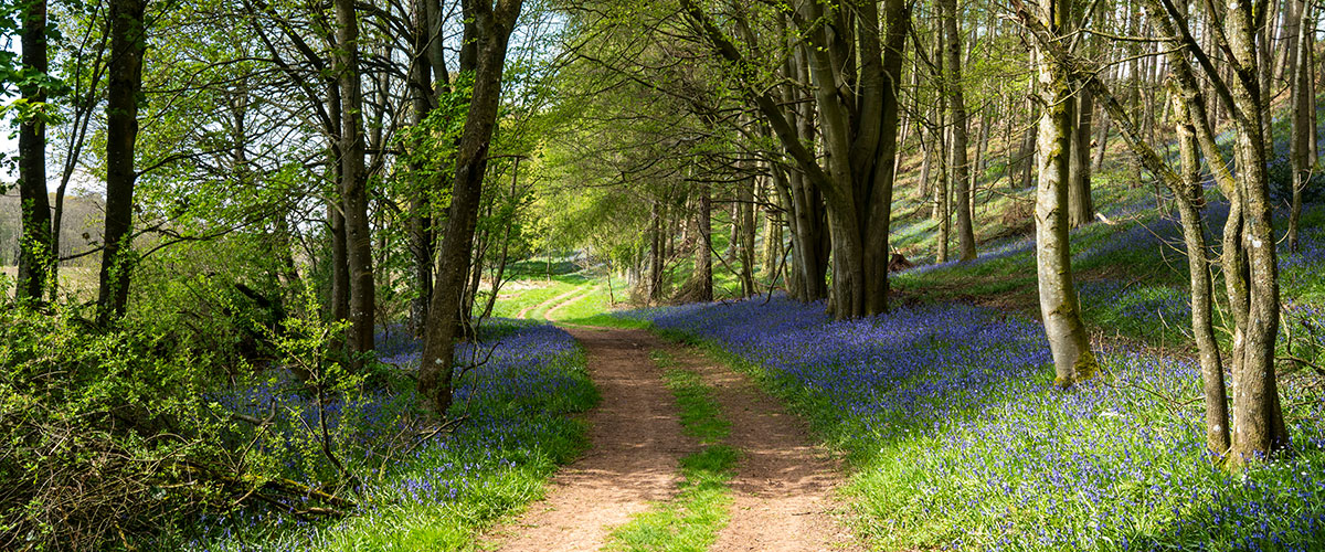
Along the way, the route passes through the North Pennines National Landscape, the Eden Valley, the Howgill Fells, the Yorkshire Dales National Park, the Lake District National Park and alongside Morecambe Bay. Expect a range of scenery and terrain, from high fell, open moorland and rolling countryside to forests, riversides and coastal trails.
The route follows good footpaths and is relatively easy to follow, ensuring a great walking experience for a range of ages and abilities. The route also crosses lesser known areas, allowing walkers to immerse themselves in beautiful, rural landscapes and discover something new. The full route is broken down into 6 sections for ease of planning.
Planning your walk
When planning your walk along the Westmorland & Furness Way, it’s important to think about your level of experience and fitness. Consider how many days you would like to walk for and how far you would like to walk each day, including the compounding effect of walking for several days in a row and potentially also carrying a rucksack.
If you are new to long distance walking, it’s a good idea to start with a conservative daily distance. This will also allow for plenty of stops to explore and appreciate the beautiful surroundings.
The Westmorland & Furness Way can be enjoyed in several ways - on a day trip, on a weekend adventure, or as a spectacular walking holiday across the full route. Take a look at our suggested itineraries for ideas and also suggestions for how to break down the full route into separate walking days.
You may decide to complete the route in sections, returning year after year to complete a few more days. This is a great option to enjoy the full route in a more relaxing way. Don’t forget to purchase your Walker’s Passport to keep a record of your progress.
When planning your walk, it’s also important to think about how you will access the route and where you will stay. As the route passes through popular hotspots and also very rural areas with limited accommodation options, we advise carefully planning all of this in advance.
You may decide to use one accommodation as a base and organise taxi transfers to complete sections of the route (returning to the same place each evening). If so then we advise booking this in advance and asking your accommodation provider for advice. When looking at food and drink options along the route, we would also advise checking opening times of any cafes and pubs in advance, and organizing a packed lunch with your accommodation provider in advance if needed.
Clothing and equipment
When planning your walk, it’s important to consider the clothing and equipment that will make your experience comfortable and safe - ensuring an enjoyable walk. Weather in Cumbria can also change rapidly so it’s important to be prepared for all conditions.
You should choose sturdy foot wear with good ankle support and grip. This will help you navigate the terrain and provide support when walking for consecutive days. Footwear should be broken in. Carrying a kit to treat blisters is also a good idea.
With regards to clothing, lightweight, quick drying material will be most comfortable when walking. Choose a layering system to give you options depending on the conditions (think base layer, midlayer and a waterproof outer layer). A hat and gloves are essential in poor conditions while sun protection and a cap will be needed for sunny days. We would always advise carrying a good quality waterproof jacket and trousers in Cumbria!
As for your rucksack, choose something that is comfortable and that you are used to wearing. Make sure you have enough water carrying capacity for the conditions (consider when you can refill). You may want to take a rucksack cover or dry bags to keep your things dry in poor weather.
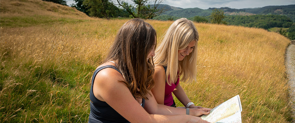
As for navigation, we advise a compass and maps to cover the route - OS Explorer Maps OL31, OL19, OL7, OL6 (1:25,000) cover the full route or OS Landranger Maps 86, 91, 97, 96 (1:50,000). The GPX files for each section are available for download on the section pages.
Essential safety equipment includes a headtorch (with spare batteries) - in case you are benighted, a whistle to attract attention, a small first-aid kit, and an emergency foil blanket or bivvy bag to keep warm.
Staying safe
It’s important to consider how to stay safe in rural areas or over high ground. Always plan your walk according to the weather forecast - Mountain Weather Information Service (MWIS) provides a specific mountain forecast if venturing onto higher ground. Be ready to adapt if conditions change and remember that the temperature can be much lower and the conditions much worse the higher you climb into the hills. Sometimes choosing the lower route, like on section three, will be the safer and more enjoyable option.
In terms of navigation, it’s best not to rely solely on a mobile phone. Mobile signal can be very patchy in rural areas or on remote fells and cold weather can drain batteries quickly. If you do choose to use a GPS app then make sure you download the full route offline beforehand and carry a charged power bank. Carrying the relevant paper maps, and knowing how to read them, is always the safest option.
Take sufficient food and drink for the distance you plan to walk including some high energy snacks. If you choose to refill water from natural sources then we recommend filtering the water or using water purification tablets.
It’s a good idea to always share your itinerary with someone and let them know when you plan to check in. Look after yourself while on the route, take regular breaks and pace yourself.
If you choose to swim in open water along the route, be aware of local conditions, enter the water slowly to avoid cold water shock and if you get into difficulty, tilt your head back, submerge your ears, try to relax and control your breathing while using your hands to stay afloat.
Walkers should remain vigilant of passing traffic at road crossings and on the short sections where the route follows quiet, country roads.
In case of an emergency while walking the Westmorland & Furness Way, dial 999, ask for the police and then ask for Mountain Rescue. Be prepared to give your exact location (using an OS grid reference or What3Words).
For further advice on this topic, please check the Adventure Smart website.
Tips for being a responsible walker
Being a responsible walker on the Westmorland & Furness Way means respecting the fragile mountain landscape, local communities, and flora & fauna along the route.
- Leave gates as you find them and stick to footpaths.
- You should keep dogs under control especially around livestock and ground-nesting birds.
- Leave no trace and take all litter home, including biodegradable items like apple cores and banana skins which biodegrade very slowly and can be harmful to wildlife.
- Respect the natural environment by leaving plant life alone (no damaging or removing plants, flowers, or trees) and keep a respectful distance from wild animals and livestock.
- Dispose of waste properly and make sure you use public toilets along the route where possible. If caught short on the fells then step well away from any watercourses, dig a small hole and pack out any toilet paper.
- Shop locally where you can to support rural communities. Buying supplies, meals and drinks from local cafes, pubs and restaurants will help support local economies along the route.
- Be considerate and show respect for the communities you are passing through as well as other trail users.
- If driving then leave your vehicle in a designated car park. Do not block narrow lanes, farm gates or other access roads. This could prevent access for Mountain Rescue or other emergency vehicles as well as local businesses and people.
- Know the rules on wild camping - it’s not legally permitted without landowner permission, however camping in the fells, above 400m, is generally tolerated if done responsibly. If camping you should be discreet, use a small tent, only stay for one night and leave no trace.
- Do not light a campfire or use a disposable BBQ due to wildfire risk and ground damage - a lightweight camping stove is the advised option.
Find out more about the Countryside Code here
 From cool campsites to stylish hotels and cosy cottages, the Westmorland & Furness Way offers a wide range of places to stay, whatever your taste.
Search
- Accommodation
- Things to Do
- What's On
- Food & Drink
Accommodation
Things to Do
What's On
Food & Drink
Accommodation
Things to Do
What's On
Food & Drink
Follow The Lake District, Cumbria on Social Media
Receive all the latest news, special offers and information from the Lake District, Cumbria


Ratings Powered By


© Cumbria Tourism